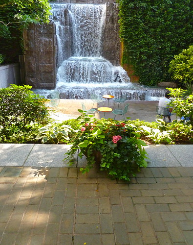
Greenacre Park in midtown Manhattan was opened for the people of New York City by the late Mrs. Jean Mauze, founder of Greenacre Foundation, on October 14, 1971 in the "hope that they will find here some moments of serenity in this busy world." Mrs. Mauze, the former Abby Rockefeller, dedicated the park to her brother, Laurance, and to his longtime associate, the late Allston Boyer, in recognition of their invaluable assistance in its creation.
{from the Greenacre Park brochure}
Reston 20/20 is an independent Reston citizens committee dedicated to sustaining Reston's quality of life through excellence in community planning, zoning, and development.
Reston Spring

Reston Spring
Wednesday, December 29, 2010
Photo of the Day: Greenacre Park, Central Manhattan--Creating Beauty in Small Urban Places
This small park (about 1/7 acre) shows how a community can create beautiful open spaces in middle of densely packed development. See the series of pictures of Greenacre Park.
Tuesday, December 28, 2010
Dulles Corridor Area Traffic with GMU Forecast for Reston, Fred Costello, September 2010
This is another in a series of papers prepared by Fred Costello, member of the Reston Task Force, on the traffic impacts of proposed development in Reston's TOD areas. As usual, it's thorough, methodical, and insightful. It's also complex. Here is this layman's summary of the paper's conclusions:
The paper examines 16 intersections along the Dulles Corridor in Reston: The intersections of Sunrise Valley and Sunset Hills as well as the east- and west-bound ramps of the Dulles Toll Road with Hunter Mill, Wiehle, Reston Parkway, and the Fairfax County Parkway. He examines data for both the morning and evening peak and for open/closed right-hand turns. He measures the percent of vehicles that (a) clear in a light cycle and (b) are stored in a light cycle at present and in 2050 using GMU's projected intermediate residential and non-residential populations from the paper they presented the Reston Task Force. In short, he makes assesses 128 data points for both the present and the future (2050). Some very basic findings from this data set--evidenced in the ending spreadsheets--include:
Those of a quantitative bent will want to read the entire paper where Fred details his assumptions, methodology, and conclusions.
Dulles Corridor Area Traffic With GMU Forecast for Reston, Fred Costello, September 2010
The paper examines 16 intersections along the Dulles Corridor in Reston: The intersections of Sunrise Valley and Sunset Hills as well as the east- and west-bound ramps of the Dulles Toll Road with Hunter Mill, Wiehle, Reston Parkway, and the Fairfax County Parkway. He examines data for both the morning and evening peak and for open/closed right-hand turns. He measures the percent of vehicles that (a) clear in a light cycle and (b) are stored in a light cycle at present and in 2050 using GMU's projected intermediate residential and non-residential populations from the paper they presented the Reston Task Force. In short, he makes assesses 128 data points for both the present and the future (2050). Some very basic findings from this data set--evidenced in the ending spreadsheets--include:
- Today, half--64 of the 128--data points seriously or marginally fail meeting the criteria laid out for success, i.e.--clearing a waiting queue of vehicles in a single light cycle, in traffic hours. In 2050, he projects that 89 percent of the points measured (70%) will fail under the same conditions.
- The intersections that currently fail marginally or seriously on all four metrics (AM & PM, % clearing, % waiting)--that is, the worst of the worst--include Sunrise Valley at 7100, Reston Pkwy, and Hunter Mill. In 2050, the worst of the worst include:
- Sunrise Valley at all four intersections (i.e.--adding Wiehle)
- Sunset Hills at all the intersections except 7100.
Those of a quantitative bent will want to read the entire paper where Fred details his assumptions, methodology, and conclusions.
Dulles Corridor Area Traffic With GMU Forecast for Reston, Fred Costello, September 2010
Monday, December 27, 2010
Photo of the Day: Balmy August Evening in Town Square Park
On this brisk, OK, downright blustery, December day, I thought it would be good to remind Restonians of the lazy days of summer. How about this photo of Town Square Park taken in on a balmy mid-August Sunday evening? This should warm the cockles of your heart.

Just a reminder: This photo is one of several hundred taken of Reston on the Reston 2020 Flickr website. Check it out!

Just a reminder: This photo is one of several hundred taken of Reston on the Reston 2020 Flickr website. Check it out!
Gridded Streets, Fred Costello, November 15, 2010
Reston Task Force member and engineer Fred Costello tackles the mantra by TOD proponents that gridded streets in TOD areas improve traffic flow. He finds otherwise:
Gridded Streets, Fred Costello, November 2010
The conclusion is that, except in unusual circumstances of small block sizes and a short distance from origin to destination, a grid of streets cannot be justified on the basis of traffic flow. The disadvantages of a grid of streets, as compared to a grid of walkways (between buildings), are the greater space between buildings and the greater hazard to the pedestrians. Greater distances between buildings result in less efficient land use and longer walking distancesFor the details of his analysis, read the two-page analysis below.
Gridded Streets, Fred Costello, November 2010
Sunday, December 26, 2010
Lesson from the Rosslyn-Ballston Corridor: Easing Congestion by Raising the Residential/Non-Residential Mix, Kevin A. Zigadlo and Fred Costello, July 28, 2010
One of the reported effects of the use of TOD around Arlington's Metro stations over the last 20 years has been a relative (and, in a few cases, absolute) decline in traffic congestion along the Rossly-Ballston Metro corridor. In this paper, Reston Task Force member Fred Costello and an associate in his engineering consulting firm, Kevin Zigaldo, show how Arlington County eased traffic congestion along the Rosslyn-Ballston corridor over the last two decades. Here is the bottom line:
...The graphs show why traffic has been improving: over the years, the number of offices (in the Rosslyn-Ballston corridor) has been decreasing relative to the number of residences so more people are able to live near their work. This improvement was made possible by requiring residential development to occur before or simultaneously with commercial and allowing a larger FAR for residential than for commercial. . . Because for the past 20 years the ratio of the added non-res-to-res has been 0.6, traffic has improved substantially.
The full report is offered below. Caution: It's wonky!
Thursday, December 23, 2010
Reston TOD Redux: The Reston Transit Charette--2002
You never know what Google will turn up as it churns through the worldwide web. Today, it grabbed the presentation below entitled, "Reston Charette: Transit," from July 2002.
As it describes in the opening viewgraphs, it is the product of a multi-day citizens' symposium (charette) to garner citizen support for Metrorail and to look at what Reston citizens thought would be desirable for transit and transit station areas around Wiehle and Reston Parkway. It's an interesting read now as we go through the Reston Task Force effort to look at the transit-oriented development (TOD) around Reston's (still) prospective Metrorail stations.
A couple of observations:
Plus ca change, plus le meme chose!
As it describes in the opening viewgraphs, it is the product of a multi-day citizens' symposium (charette) to garner citizen support for Metrorail and to look at what Reston citizens thought would be desirable for transit and transit station areas around Wiehle and Reston Parkway. It's an interesting read now as we go through the Reston Task Force effort to look at the transit-oriented development (TOD) around Reston's (still) prospective Metrorail stations.
A couple of observations:
- It highlights "common ground" facilities at Reston Parkway Station, including air rights, a 700-seat performance hall, county and community facilities, and some other amenities at a cost between $105-119 million. (See p. 7.) Wow! What a bargain! Why now are these facilities considered too expensive? (Also, see p. 24, which graphically displays "common ground" at Reston Parkway station. The concept, including redevelopment south of the station, is similar to that presented by Reston 2020 to the Reston Task Force within the last month.)
- It encourages more residential development in the TOD areas, noting "out of balance in massing more and more office volumes." (p. 10)
- As the Task Force has just recommended, the Metro stations should have the word "Reston" in their title. They should also include public art, good bike facilities, rideshare coordinator, and other features recommended by Reston 2020 in its working papers. (p. 32)
- There is no discussion of Town Center North as being part of or linked to the Reston Parkway Station TOD area.
- In general, the development proposed for the two TOD areas is MUCH less than that now on the table for either station area. Why?
Plus ca change, plus le meme chose!
Labels:
Arts Center,
Density,
Public Art,
Reston Parkway Station,
TOD,
Wiehle Station
Silver Lining: 'Traffic Will Always Be Bad in Northern Virginia', Lauren Sausser, Falls Church Patch, December 22, 2010
All that construction probably won't change how bad the traffic is.The rest of this article is available here.
In this series, Patch looks at the Silver Line, Metro's largest expansion in its 34-year history.
The Dulles Metrorail is expected to remove thousands of cars from Northern Virginia's roads and ease the daily gridlock that has come to characterize the region.
But some question whether traffic will ever improve — even with the addit
ion of the 23-mile Silver Line to the existing 106-mile Washington Metro system.
"There are some parts of the country that would be glad to have traffic, because it indicates someone wants to get somewhere. It's better than depression," said Zachary Schrag, an associate history professor at George Mason University, who specializes in transportation issues. "No jobs, no traffic."
Schrag said other metropolitan regions, like Houston, have simply continued to add lanes to their highways to accommodate more drivers.
"Part of the story here is this political debate about how we want the region to grow," he said.
The bottom line is that it is hard to predict ridership numbers for the new Metro line, Schrag said. But Eileen Curtis, president of the Dulles Regional Chamber of Commerce, said she is confident that the biggest benefit of building the new line will be getting more drivers off the road and onto the Metro. . . .
Comment: Fairfax County's Department of Transportation expects that, in 2030, more than a decade after the arrival of Metrorail in Reston, traffic congestion will more than double at key intersections near Reston's Wiehle and Reston Parkway station. (See this presentation below.) That estimate is based on development under the current Comprehensive Plan. The new TOD development plans now under consideration by the Reston Task Force could see those delays increase significantly over the next 20 years.
Silver Lining: How Future Economic Development Justifies Hefty Price Tag, Lauren Sausser, Falls Church Patch, December 21, 2010 (Part II of III)
The cost of not building the Silver Line exceeds the $6.5 billion price tag, economists say.
In this series, Patch looks at the Silver Line, Metro's largest expansion in its 34-year history.
When the Dulles Metrorail is fully up and running — probably sometime in 2016 — it will likely have cost a grand total of about $6.5 billion to build.
And while some may balk at that price tag, several regional experts say this "megaproject" is vital to Northern Virginia's economic vitality.
"Many people likely take the ongoing expansion of Northern Virginia for granted, given how vibrant the region's economy has been over time and is today. It has become an economic juggernaut," said Anirban Basu, the CEO of Sage Policy Group. . . .
Read the rest of this article here.
Comment: The implication of the official spokespersons in this article is that those who oppose the Metrorail Silver Line oppose any public transit. This is not generally true. Most Metrorail Silver Line opponents believe bus transit--including bus rapid transit to Dulles--would provide a more timely, flexible, accessible, and less expensive option that would serve the same purpose, maybe even more effectively.
A Lasting Legacy to Reston, Reston Connection, December 20, 2010
Dave Edwards named Reston Citizen of the Year.Click here for the rest of this article.
By Alex McVeigh
Monday, December 20, 2010
Dave Edwards moved to Reston in 1967, and immediately set to work making the community a better place. He helped found the Reston Community Association, which is now the Reston Citizens Association, and 43 years later, the organization named him their Reston Citizen of the Year.
"I haven't done anything of great proportion," Edwards said about being named Citizen of the Year. "I'm just plugging along."
COMMUNITY MEMBERS from around Reston would disagree with Edwards' assessment, whether it's the RCA, the Reston Community Center (which he helped plan) or the current group planning for the future of Reston. . . .
Dave Edwards was named the Reston Citizens Association Citizen of the Year for 2010
Wednesday, December 22, 2010
Notes from the RTF Steering Committee Meeting, December 20, 2010, Terry Maynard
Patty Nicoson, Task Force and Steering Committee Chair, stated at the outset of this initial meeting of the Steering Committee (SC) that the meeting would try to understand how FC conducts the planning process, and treats planning & zoning. Thereafter, the meeting was turned over to Mark Looney who provided a two-hour walk-through of the planning and zoning effort (2006-2009) for "Central Springfield," the area around Springfield Mall.
Looney literally did a page-by-page review of the planning and zoning documents (hundreds of pages) to show what was done, the implication—and state purpose--being that this approach and these documents might be useful for plan language in Reston. Looney stressed over and over how many reviews the long-suffering landowner/developers had to go through in the processes of the county--a constant theme. When Looney was done, Heidi noted that the Springfield example "helps understand how planning and zoning can be addressed . . ., "but she discouraged the SC from aspiring to this level of detail.
Comment: I do not think the Springfield example is applicable to Reston’s three TOD areas. It covers only an 80-acre site (vice ~800 in RTC, ~400 in Wiehle, & ~200 in H-M, excluding west of Monroe). The land is owned by 5 property owners working together to save a badly failing shopping center. They presented a re-development proposal that shaped the concurrent development of planning and zoning language around a single re-development concept. We generally have many property owners (depending on TOD area), they are not cooperating yet, there is no property consolidation, nor is there a re-development plan in any of the Reston TODs. The Springfield area is not a TOD area--Huntington is a half-mile from the nearest point in the scheme.
The SC barely addressed infrastructure in the Springfield re-planning, and did so in a way that was limited using generally non-binding language.
The transportation plan was developed after the zoning application was filed, but before project approval. Comment: This is a bad idea. We need an integrated transportation plan as part of the revised County CP with specific funding sources identified (a problem Tysons is still wrestling with 6 months after the new CP was developed). As Reston 2020 has noted in the title of its implementation paper, “Planning without implementation is empty.” The transportation plan did recognize the need for an internal circulator and a circulator link to "main" Springfield across I-95, but nothing else I discerned (e.g.--more bus service to Metro 1/2 mile away to the east). The owners agreed to contribute (i.e.-“voluntary”) $4.31/SF for non-residential space and $863/DU—about $0.72/SF under Reston planning assumptions of 1,200GSF per DU--with an inflation adjustment to a special road fund internal to the development. There was a process to make sure those roads were built. They also agreed to fund the operating cost ($210K/yr. for increased bus service (linking to main Springfield) for up to five years, after which it would be FC's responsibility. They did not agree to fund any capital costs associated with the new bus services.
Open space-like issues were covered as follows: The owners would provide $1.6MM to improve an OFFSITE park and $1MM to put artificial turf on nearby Lee HS' football field. That's it; no discussion of on-site open space to serve residents, employees, or visitors.
Open space-like issues were covered as follows: The owners would provide $1.6MM to improve an OFFSITE park and $1MM to put artificial turf on nearby Lee HS' football field. That's it; no discussion of on-site open space to serve residents, employees, or visitors.
Comment: Patty Nicoson seems to have caved to developer interests to use this forum to take vision function from Vision Committee. It still leaves a confused picture to be sorted out--what then is the Vision committee's function?
The next meeting of the SC will be on January 4, 7PM, at RCC-Lake Anne, in lieu of a Task Force meeting.
Present were: Patty, Heidi, Paul Thomas, Bill Penniman, Robert Goudie, Kohann Williams, John Carter, Mark Looney, and Van Foster, plus some developer hangers-on, plus Reston 2020 reps John Lovaas & myself in the audience.
Present were: Patty, Heidi, Paul Thomas, Bill Penniman, Robert Goudie, Kohann Williams, John Carter, Mark Looney, and Van Foster, plus some developer hangers-on, plus Reston 2020 reps John Lovaas & myself in the audience.
Tuesday, December 21, 2010
Silver Lining: Light at the End of the Track, Falls Church Patch, December 20, 2010 (Part I of III)
The end of the project is in sight, but the day passengers climb aboard isn’t.By Lauren Sausser
In this series, Patch looks at the Silver Line, Metro's largest expansion in its 34-year history.
The first 11.7-mile phase of the new Dulles Metrorail is scheduled for completion in less than three years, but there is no official prediction when the line will actually open for commuters.
The Metropolitan Washington Airports Authority — which is managing the new Silver Line construction — says it cannot estimate an open-for-business date because safety tests will be conducted on the new rail after construction is finished and Metro employees must be trained to operate the new track.
"At this point in time, we haven't worked out the details," said Pat Nowakowski, executive director of the Dulles Metrorail Corridor Project. . . .
For the rest of this article, click here.
Saturday, December 18, 2010
Photos of the Day: Locally Owned--Mayflowers Floral Studio and The Bike Lane

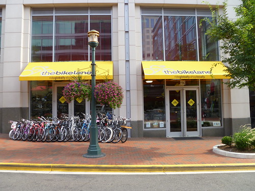
As Reston develops, especially around the new Metrorail stations, it will be even more important to enable locally-owned businesses to have an opportunity to serve the community. Here are two of those businesses, Mayflowers Floral Studio at Plaza America and The Bike Lane in Reston Town Center.
For move photos of locally-owned businesses in Reston, check out this set in Reston 2020's Flickr photostream.
Future Reston Traffic along the Dulles Corridor, FCDOT Presentation, December 14, 2010
At last Tuesday evening's Reston Task Force meeting, the County's Department of Transportation (FCDOT) presented its forecast of traffic conditions in 2030 along the Dulles Corridor. A summary viewgraph in this presentation (Slide 5) shows that a dozen intersections between Hunter Mill and Fairfax County Parkway earn failing ("F") grades during peak hour service.
The FCDOT presentation shows that peak hour traffic delays will be much, much longer twenty years for now at Wiehle and Reston Parkway intersections at Sunrise Valley and Sunset Hills. (The presentation didn't discuss the Fairfax County Parkway intersections with these two east-west streets, but the intersection with Sunrise Valley Drive is literally the worst for total peak period traffic and congestion.) A quick look at the FCDOT forecast shows the following increases in delays:
I recommend that you take a look at the full presentation provided below.
Reston Peak Traffic Conditions, 2030 Forecast, FC DOT, 12-14-2010
The FCDOT presentation shows that peak hour traffic delays will be much, much longer twenty years for now at Wiehle and Reston Parkway intersections at Sunrise Valley and Sunset Hills. (The presentation didn't discuss the Fairfax County Parkway intersections with these two east-west streets, but the intersection with Sunrise Valley Drive is literally the worst for total peak period traffic and congestion.) A quick look at the FCDOT forecast shows the following increases in delays:
- Overall, we can expect peak hour traffic delays to more than double at the studied intersections (125%) over the next two years. That means that the average peak hour delay at the specific intersections studied will go from just over one minute (68 seconds) to more than two and one-half minutes (153 seconds). (Note: The FCDOT analysis is based on MWCOG estimates of future traffic, and MWCOG estimates do NOT include the full impact of the intense development being proposed in the TOD areas around the Metro stations. In short, traffic will be worse than estimated.)
- Of the seven intersections FCDOT discussed in depth, six will earn "F" grades whereas only two have "F" grades now. (Note: There are other lanes and turns at these intersections that were not discussed, as well as not discussing Fairfax Parkway.)
I recommend that you take a look at the full presentation provided below.
Reston Peak Traffic Conditions, 2030 Forecast, FC DOT, 12-14-2010
Labels:
Congestion,
TOD,
Traffic analysis,
Transportation
Thursday, December 16, 2010
Numbers Show Stable, Smaller, Richer Reston, Karen Goff, Reston Patch, December 15, 2010
American Community Survey provides a look at who lives here.
The Reston of 2010 is a little smaller, a little older and a little wealthier than it was in 2000.
For all the details, click here.The US Census Bureau this week released its American Community Survey information. This is not the official 10-year census, but rather a snapshot of individual communities in the period of 2005-2009. . . .
I, for one, am a little skeptical of data--even Census Bureau data--that shows Reston's population shrank over the last decade. The same data set shows that nearly 2,400 new housing units were built in Reston in the decade, and its hard to imagine this 10% increase in homes still resulted in a 5% population decline. I doubt household size shrunk that much, even if we're a little older (empty nesters) and the dwelling units built this decade were largely high-rise, high-density condos & rentals (with presumably smaller households).
I'll wait for the results of the full 2010 census rather than this five-year survey estimate to be persuaded that Reston has fewer people than a decade ago. Still, an interesting set of data to mull over.
Wednesday, December 15, 2010
Photo of the Day: Hickory Cluster, A Reston Original Designed by Charles M. Goodman
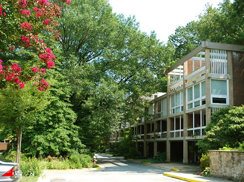
Charles M. Goodman (1906–92) was an American architect who made a name for his modern designs in suburban Washington, D.C. after World War II. While his work has a regional feel, he ignored the colonial revival look so popular in Virginia.
en.wikipedia.org/wiki/Charles_M._Goodman
Differing Visions for the Future, Alex McVeigh, Reston Connection, December 14, 2010
Reston 2020 offers alternative vision for Reston Town Center.
The Reston 2020 committee, part of the Reston Citizens Association, presented an alternate vision for the future of Reston Town Center Dec. 7 at the weekly meeting of the Reston Master Plan Special Study Task Force. Their vision was meant to be an alternative to the report presented by the Reston Town Center subcommittee Nov. 5.
The Reston Town Center subcommittee placed a priority on expanding the existing urban core to get it closer to the proposed Reston Parkway Metro stop. Reston 2020's report suggested that the subcommittee's report is lacking in several fields.
"The Town Center Subcommittee report recommends excessive development and understates requirements for robust internal infrastructure and key quality of life amenities," the report reads. "[We] need a vision and plan for Reston Town Center that meets three key objectives: meets future economic growth expectations, opportunities and restraints, sustains multi-faceted world class planned community in an urban setting and abides by [transit oriented development] principles and best practices."
THE REPORT recommends a population-driven 20-year plan that balanced the various populations -- residential and workforce -- with Reston's quality of life in an urban setting....
For the rest of this thorough report on the discussion of the future of Reston Town Center, please click here.
Reston Just Needs a Little Work, Justine van Engen, Reston Patch, December 14, 2010
Pretty gets harder to achieve when one is over 40.
. . . I get it now. I have finally figured out what I have to contribute to the discussion of Reston's zoning, development, cosmic alignment and Feng Shui that seems to take up every other resident's time but my own. I had thought the committees and sub-committees were delving into code, policy, philosophy, and the fundamental concept of property ownership. Imagine my surprise when I learned that it all boiled down to a matter about which I am practically an expert: the care and maintenance of a body over the age of 40.
Reston is 46 years old and her indiscretions of youth are beginning to show themselves. She disdained the American death industry and shunned the notion of putting in a cemetery, a decision she might regret. She caved in to the pressure to have more parking and allowed New Dominion Parkway to leave a scar across her midsection. Like most of us as we age, her proportions grew larger, her façade needed more work to maintain, and her relationships grew more complicated.
It's okay. She just needs advice from her friends. And I am a friendly person. Here is the help she has been waiting to receive. . . .To read Justine's advice, please click here.
Labels:
Metrorail,
Natural areas,
Open Space,
Urban Design
Tuesday, December 14, 2010
Photo of the Day: Reston Heritage--The A. Smith Bowman Distillery

From the A. Smith Bowman website:
A. Smith Bowman's distilling roots date back to the years before Prohibition. In 1927, after the Repeal of Prohibition, Abram Smith Bowman and his sons relocated to Virginia continuing the family tradition with the distillation of bourbon. The original distillery was located on the Bowman family homestead in Fairfax County, Virginia called Sunset Hills Farm.Wikipedia adds the following about the building:
The building in which the distillery originally operated was constructed circa 1892, serving as the town hall for Wiehle, as well as a church. It was listed on the National Register of Historic Places National Park Service in 1999, and has been the subject of several rezoning applications. A proposal to construct condominiums on the site was approved September 24, 2007. An earlier version of the proposal mentioned 8 units as new buildings (on 0.23 acres), in addition to constructing 3 units within the historic structure, while noting that it replaced a planned use of the structure as cultural center (i.e., for the Greater Reston Arts Center).
Story goes that Bob Simon was actually testing the fine Virginia bourbon whiskey at the distillery shortly after it opened in 1934 when he came up with the new-fangled idea of a "planned community" in the wilds of northern Virginia linked to Washington by the fine Washington & Old Dominion rail line. One could also ride a horse, take a carriage, or drive one of Mr. Ford's Model T's down the Leesburg Pike to Tysons Corner (back when it was just a corner) and then on to Old Dominion to Chain Bridge to get to the capital.
OK, that's not exactly how it went down, but it's easy to imagine! What is true is that this century-old building has served as a town hall, a church, and a distillery. Seems like a pretty good lifetime mix of uses!
Enjoy!
Monday, December 13, 2010
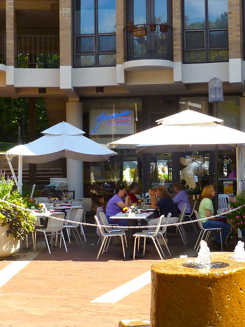
Reston Photo of the Day: Lunchtime at Jasmine's Cafe, Lake Anne Village,September 28, 2010
On a blustery December day like today, it seemed like no better time than to start a new regular feature on the Reston 2020 blog: A Reston photo of the day. In this case, what could be warming that a photograph of people enjoying a delicious luncheon at Jasmine's at Lake Anne on a balmy September afternoon. Kinda helps take the chill out of the day.
I'll keep posting various photographs of Reston in the weeks an months ahead, although probably not everyday. All the photographs will come from Reston 2020's Flickr site. Check it out for yourself.
In the meantime, stay warm.
Reston 2020 Comment on Wiehle Sub-Committee Final Draft Report, December 10, 2010
Labels:
Density,
Mix of Uses,
Open Space,
Reston 2020,
Transportation,
Urban Design,
Wiehle Station
Wiehle Sub-Committee Final Draft Report, December 10, 2010
The Wiehle Sub-committee will be presenting this report at tomorrow evening's meeting of the Reston Task Force, 7PM, Reston Community Center--Lake Anne.
Reston Wiehle Subcommittee Draft Final Report 12-10dr--Clean
Reston Wiehle Subcommittee Draft Final Report 12-10dr--Clean
Labels:
Density,
Mix of Uses,
Open Space,
Urban Design,
Wiehle Station
Friday, December 10, 2010
Draft Agenda: Reston Task Force Meeting, December 14, 2010
DRAFT
RESTON MASTER PLAN SPECIAL STUDY
TASK FORCE
December 14, 2010
Task Force Meeting
Reston Community Center at Lake Anne
AGENDA
7:00 p.m. Public Comment Period
7:15 p.m. Administrative Items – Patty Nicoson, Task Force Chair
7:30 p.m. Wiehle Sub-Committee Presentation
Bill Penniman & Andy Van Horn, Co-Chairs
8:00 p.m. Supplemental Transportation Analysis
Leonard Wolfenstein,
Fairfax County Department of Transportation
9:15 p.m. Brief review of and Task Force Vote on proposed Planning Principles
Patty Nicoson, Task Force Chair
9:25 p.m. Adjourn – Patty Nicoson
Labels:
Agenda,
Task Force,
Transportation,
Wiehle Station
Thursday, December 9, 2010
Photos are worth many words: Try Reston 2020 on Flickr
Some of you may have noticed the stream of updated image thumbnails at the top of the Reston 2020 blog. These come from Reston 2020's companion Flickr site. We recommend you take a few minutes to browse the site and its diverse collections and galleries. Most are images of Reston, but there are also images of great architectural, environmental, and other successes from other cities, mostly New York.
Here are a few samples from the large and diverse set of collections:
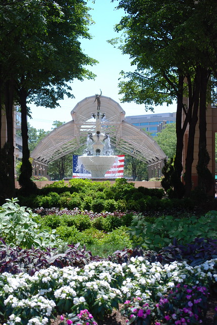
Looking Toward Mercury Fountain from Freedom Drive, Reston Town Center
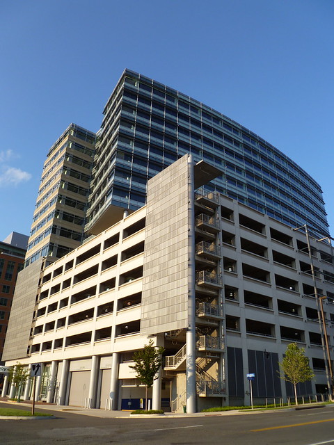
Parking Garage & Fidelity Building, Reston Town Center
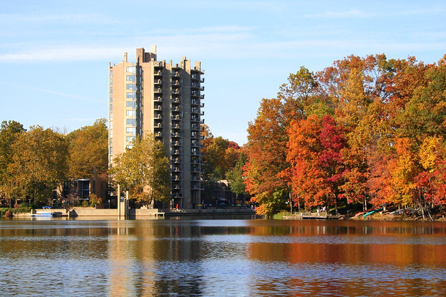
Looking North Across Lake Anne, Heron House in the Distance
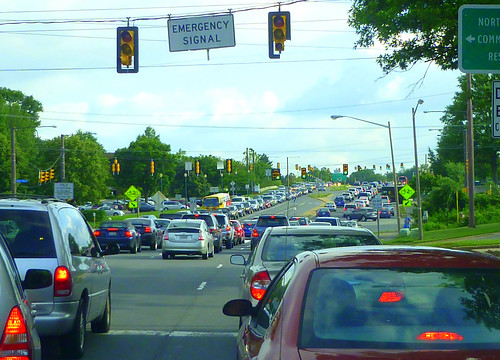
Looking South on Wiehle Avenue, Approaching Sunset Hills Road and Dulles Toll Road | Monday 6pm
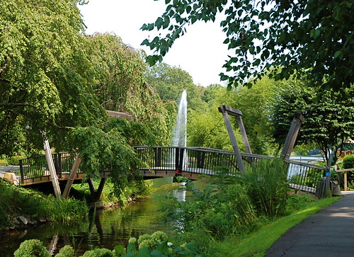
Van Gogh Bridge, Lake Anne, Reston, VA
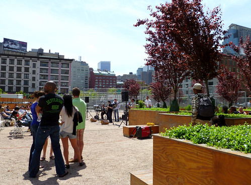
LMCC LentSpace, Downtown NYC, April 30, 2010
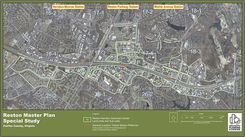
Reston Master Plan Special Study Land Units Map
CHECK IT OUT!
Here are a few samples from the large and diverse set of collections:

Looking Toward Mercury Fountain from Freedom Drive, Reston Town Center

Parking Garage & Fidelity Building, Reston Town Center

Looking North Across Lake Anne, Heron House in the Distance
 Sunrise Valley Park Wetlands, Reston, Virginia | Near Future Site of Herndon-Monroe Metro Station

Looking South on Wiehle Avenue, Approaching Sunset Hills Road and Dulles Toll Road | Monday 6pm

Van Gogh Bridge, Lake Anne, Reston, VA

LMCC LentSpace, Downtown NYC, April 30, 2010

Reston Master Plan Special Study Land Units Map
CHECK IT OUT!
Wednesday, December 8, 2010
Reston2020's Alternative Recommendations Suggest Population Explosion, Reston Patch, December 8, 2010
Group urges task force to keep growth, infrastructure in mind.
The Reston Citizen Association's Reston2020 Committee has presented an alternative proposal to the Reston Master Plan Special Study Task Force, urging the group to look at work and residential occupancy forecasts for Reston that may far exceed forecasts.
Data on the alternative town center proposal show's Reston's population could grow from around 60,000 to as much as 156,000 over the next 20 years.
That's why the alternative plan urges planning around future growth expectations; and improved transportation infrastructure; an additional elementary school; 25 percent open space; and a fine/performing arts center. . . .The rest of this article is here.
Reston 2020's presentation is here.
Labels:
Arts Center,
Density,
Education,
Infrastructure,
Reston 2020,
Reston Town Center
Tuesday, December 7, 2010
Letter: There's more than meets the eye with Reston zoning changes, Kathy Kaplan, Fairfax Times, December 8, 2010
Reston Association Board President Kathleen Driscoll McKee has mentioned in recent articles for Reston Patch and the Reston Magazine that people should get involved in phase two of the revision of Reston's master plan. In phase two, the task force will recommend zoning changes to add residential units and more commercial and retail space to the village centers. What McKee neglects to spell out is that the neighborhoods around the village centers will be considered by the task force for rezoning to high-density.
What does this mean? It means developers will be able to buy out entire neighborhoods and redevelop whenever they want. The state legislature passed H.B. 2954 in 2007, a bill which counteracts the Supreme Court's Kelo vs. New London decision. Our neighborhoods cannot be taken by eminent domain by the county to increase revenue. However, developers can "consolidate" neighborhoods by making us offers we can't refuse. They can buy us out. Once the zoning is changed, Reston will be wide open for residential redevelopment.
Currently the "footprints" of the village centers include some existing neighborhoods. The task force set up by Supervisor Cathy Hudgins (D-Hunter Mill) will consider whether to expand, contract or leave those footprints as they are.
Hunters Woods Village Center's footprint includes the following neighborhoods: Glade at Hunters Woods condos, Hunters Woods Village condos and Hunters Woods retirement apartments. In addition, Hunters Square, Hunters Crossing condos and Glenvale condos may be considered for rezoning to high-density because of their proximity to the village center.
South Lakes Village Center's footprint includes Harbor Point condos and the Thoreau Place assisted-living center. In addition, Villa Ridge condos, Lakeport and Southbridge may be considered for rezoning to high-density due to their proximity to the village center.
The North Point Village Center footprint includes The Apartments at North Point and North Point Village condos. In addition, Summer Ridge condos, Hampton Pointe condos and St. Johns Woods apartments may be considered for rezoning to high-density due to their proximity to the village center.
Tall Oaks Village Center footprint includes Tall Oaks at Reston retirement apartments, and Bentana Park condos and Villas de Espana may be considered for rezoning to high-density due to their proximity to the village center.
In her suggestions for residents to get involved, McKee has not indicated how residents may participate in the planning process. Currently the task force is heavily weighted with developers, their attorneys, architects and engineers. Many are not residents of Reston. Recently representatives of Reston Association, Reston Citizens Association and the Alliance of Reston Clusters and Homeowners suggested to Hudgins that a different configuration of the task force is needed for phase two. Local residents need to be represented to discuss and vote about possible rezoning and redevelopment of their own neighborhoods. Hudgins has indicated a willingness to consider reconfiguring the task force to include residents on various subcommittees.
Neighborhoods in the vicinity of the village centers need to appoint representatives to participate in phase two. This needs to be done now, as phase two will begin early next year.
Hudgins can be contacted at the North County Government Center, 12000 Bowman Towne Drive Reston, VA 20190, 703-478-0283, hntrmill@fairfaxcounty.gov.
Kathy Kaplan, Reston
UPDATE: Kathy's letter also appears in the Reston Patch at "Task Force Phase 2 will bring big changes."
Labels:
Hunters Woods VC,
North Point VC,
RA,
South Lakes VC,
Tall Oaks VC,
Task Force,
Village Centers
RA Video on Its Task Force Efforts, December 2010
In the first two and one-half minutes of RA's monthly "Reston Today" video, Paul Thomas, RA Board member and representative to the Reston Task Force, discusses what the Task Force is doing and how RA is putting together its own recommendations.
"Green Light to Nowhere," Video and Commentary, Rick Hamilton
Fairfax Department of Transportation Predicts Significantly Worsening Congestion for Dulles Corridor Traffic
In a presentation to the Reston Master Plan Special Study Task Force on October 26, the Fairfax County Department of Transportation (DOT) presented analysis forecasting a dramatic increase in traffic congestion through 2030. The study focused on the corridor immediately adjacent to the Dulles Toll Road and highlighted 24 critical road intersections, each assigned a level of service (LOS) from A (free flow, low traffic density) to F (forced flow with demand volumes greater than capacity resulting in complete congestion. Volumes drop to zero in extreme cases).
Of the 24 intersections, the traffic analysis showed current morning peak hour LOS at three Fairfax County Parkway and Reston Parkway intersections was already an F. Two additional intersections were rated as E. There were no intersections rated as A, and only four rated as B LOS.
The analysis then assumed major roadway improvements between 2010 and 2030, including widening of Route 28 to ten lanes including HOV lanes; widening of Fairfax County Parkway to six lanes including HOV lanes; an overpass across the Dulles Toll Road near the County line (Rock Hill Road Overpass); an overpass across the Dulles Toll Road west of Wiehle Avenue (Soapstone Overpass); widening of Centreville Road to six lanes; extension of Sunrise Valley Drive south of Frying Pan Road; completion of improvements to West Ox Road, Coppermine Road, and Reston Parkway; and widening/improvement of Fox Mill Road, Monroe Street, and Frying Pan Road. The analysis did not assume several improvements currently advocated by affected interests, including additional access to the existing Herndon-Monroe parking garage, which would relieve some of the congestion at the critical Fairfax County and Monroe Street intersections with Sunrise Valley Drive.
In 2030, the study predicted the number of F rated intersections will increase from six to fifteen, including degradation of two of the four existing B ratings to F. The analysis ignored the intersections of Monroe Street with Sunrise Valley Drive and the Monroe Street overpass of the Dulles Toll Road , which will be significantly affected by the new Metro station; did not consider Fox Mill Road intersections with Fairfax County Parkway, Monroe Street, and Colts Brook Drive which may be affected; and did not address Sunrise Valley Drive intersections with Thunder Chase Drive, Roark Court, Milburn Lane, Hitchcock Court, and Colts Brook Drive, all in very close proximity to the Metro station.
Rick Hamilton
Labels:
Congestion,
Hunter Mill,
Traffic analysis,
Transportation
Friday, December 3, 2010
Time to toll the Dulles Access Road, Fairfax Times, December 1, 2010
As Rob Whitfield, Dulles Corridor Users Group and Reston 2020 Committee regular, reports, MWAA foresees major increases in tolls on the Dulles Toll Road over the next 30-40 years. He proposes that some of that burden be shared with people driving straight to the airport on the Dulles Access Road.
Here's some of what he has to say:
For those of you who like to think in terms of "real dollars," that $17 toll 30 years from now is equivalent to about a $7 toll today with 3% annual inflation. It's as if you were paying more than three times as much than the current toll in today's dollars.
Here's some of what he has to say:
At the Oct. 25 MWAA Dulles Toll Road public meeting held in Reston, a "Dulles Corridor Financial Update" was provided including a forecast of "Anticipated Toll Revenue Bond (TRB) Debt Service" as part of the "Dulles Corridor Enterprise Finance Plan." You can see for yourself at www.metwashairports.com/tollroad/1147.htm.
The MWAA finance plan now calls for Dulles Toll Road users to pay $1.1 billion annually by 2058 with more than $700 million annually required for TRB debt service. By contrast, total planned federal capital contribution to Dulles Rail Phase 1 is only $900 million, spread over most of a decade.
The new MWAA estimates represent a near doubling in total finance costs to DTR users. At 2009 public hearings prior to approving DTR toll increases for the years 2010 to 2012, MWAA projected maximum gross toll revenues needed of more than $500 million in the 2040s, up from the $65 million collected in 2009 and the $90 million projected for 2010.
In its August 2009 bond prospectus to investors in DTR revenue bonds, MWAA forecasted that, by 2040, toll road users will be paying $6.25 at the main toll plaza and $3.75 at each ramp. Today, drivers pay $1 at the main plaza and 75 cents at other ramps.
No similar figures and underlying assumptions have yet been provided by MWAA for its latest cost forecasts but it appears that main plaza tolls by the 2040s are projected at more than $10 and ramp tolls at more than $7 (emphasis added). . . .
. . . If government leaders insist on moving forward with the infeasible and uneconomic Phase 2 of Dulles Rail, then as a first step in providing equitable treatment to DTR users, tolls should be installed on the Dulles Access Road adjacent to Dulles Airport -- a $3 one-way toll to start, plus similar parking taxes at Dulles for both passengers and airport employees. Subsequently, these rates should increase at amounts equal to or greater than the tolls to be paid by DTR users -- which are in effect taxes imposed without approval of the Virginia General Assembly. The original purpose of Dulles Rail was to serve Dulles Airport so, if it is to be built, let's encourage greater use of the train to and from the airport by passengers and employees alike.For the rest of Rob's letter click here.
For those of you who like to think in terms of "real dollars," that $17 toll 30 years from now is equivalent to about a $7 toll today with 3% annual inflation. It's as if you were paying more than three times as much than the current toll in today's dollars.
Subscribe to:
Comments (Atom)
